
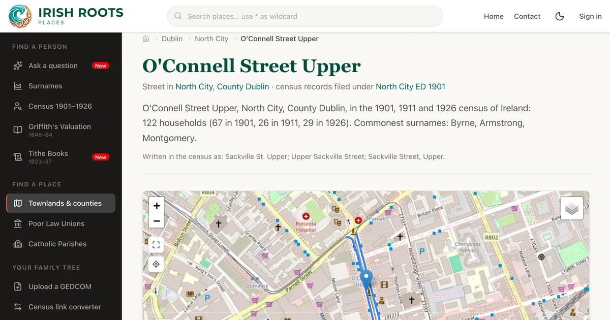
In the countryside, the census filed every household under its townland, and Irish Roots has long linked those households to townland pages and maps. Towns and cities were different. There the enumerator wrote down a street, and a street is not a townland. A family on Gardiner Street or the Falls Road had no townland page to land on, so it was much harder to find them by place.
That has now changed. We have matched the street addresses in the 1901, 1911 and 1926 censuses to real streets, and every street has its own page.
What a street page shows
Each street page brings together everyone the census recorded there:
- Households by year: for 1901, 1911 and 1926, each household with its house number, head of household and number of people, linked to the full household form
- The commonest surnames on the street, with counts for each census
- How the census wrote it: every spelling the enumerators used, such as “Sackville St. Upper” or “Upper Sackville Street”
- The street on a map, drawn from OpenStreetMap
Take O’Connell Street Upper in Dublin, which the 1901 and 1911 censuses knew as Sackville Street. Its page lists 122 households across the three censuses and the families who lived there, and shows the street on the map.
Renamed streets
Many streets have changed name since 1901, especially after independence. Sackville Street in Dublin became O’Connell Street, and King Street in Cork became MacCurtain Street. We matched these renamings so the old households land on the modern street.
You can search by either name. Type “Sackville Street” into the search box at the top of any page and it finds O’Connell Street, noting “In the census as Sackville St. Upper” underneath. Old spellings like “Lr. Gardiner Street” work too.
Some streets have gone altogether, cleared, built over or never named on a modern map. They still get a page, placed in their electoral division, so their families aren’t lost.
All 32 counties
Streets cover the whole island for 1901 and 1911, so Belfast, Derry, Newry and Enniskillen are in, as well as Dublin, Cork, Limerick and Galway. The 1926 census covers the 26 counties of the Irish Free State, so streets in the six counties show 1901 and 1911 only.
In all, more than 15,000 streets now hold close to 600,000 census households between them.
Following the records
Street pages connect to the rest of the site:
- Household pages now show the street, so from any town household you can step out and see the neighbours
- Electoral division pages list their streets, and townland pages in towns list the streets within them
- Each street page names the electoral division as the census wrote it, “North City” for example. Where the households are filed under a historic division, such as “North City ED 1901”, the page links to that too, so you can follow the original arrangement of the returns
More 1926 households linked to their place
When we launched the 1926 census on Irish Roots, about 60% of its households were linked to a townland. Many 1926 districts were renamed or redrawn from the 1911 ones, so we matched them against the 1926 district boundaries and relinked the households. Now 74% of 1926 households are linked to a townland, and with streets added over 93% are linked to a townland or a street. For 1901 and 1911 the figure is over 96%.
We also tidied up electoral divisions that appeared twice under slightly different names. The duplicates have been merged and their old links redirect to the right page.
Where to start
If you know the address from a census return, a civil record or a family letter, type the street name into the search box, old name or new. If you only know the town, open its electoral division and browse the street list. Or find a family in the census search and follow the street link from their household.
Census records from the National Archives of Ireland. This work includes content from records of the 1926 Census of Ireland, made available by the National Archives of Ireland under the Creative Commons Attribution 4.0 International (CC BY 4.0) licence. Street lines © OpenStreetMap contributors, available under the Open Database Licence.